Pay As You Sail
Pay As You Sail (PAYS) radically simplifies the procedure of purchasing charts for marine navigation. Mariners have access to a full, up-to-date chart portfolio allowing them to plan any routes they need without specifying the charts in advance. Vessels are automatically charged for the charts that they sail through, and not the full chart portfolio.
PAYS integrates on-board satellite vessel tracking, back-of-bridge online chart updating, and back-office fleet management tools to form the perfect solution for chart agents, shipping companies and private ship owners.
We developed the system with major chart agent Weilbach and achieved DNV-GL approval in March 2016.

Advantages
- The charts you need are always up to date and accessible on board
- Reduced administration time as chart permits are downloaded automatically
- Pay for charts when the vessel enters the chart area
- No need to order chart permits individually
- Reduces planning workload on a vessel
- Easy to use and install
- Reliable and compatible with any ECDIS
- Works with all S-63 charting systems
- Removes major risk to vessel safety by having correct permits on board
Example applications
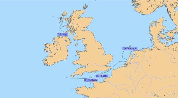
- Commercial tramp vessels sailing unscheduled routes
- Commercial fleets sailing in hazardous locations or conditions where exit contingency routes are vital
- Shipping companies tracking their fleet of vessels
- Vessels where ECDIS is mandatory
Safety critical
Missing or out-of-date charts are a compliance issue and a major risk to vessel safety. PAYS avoids this by having a set of official ENC charts accessible at all times. This has radically simplified the procedure of having to licence charts cell-by-cell in advance.
Time saving
Having PAYS on board a vessel ensures all charts are available immediately. This saves time checking if new or updated charts are required, and purchasing any missing charts and permits.
Vessels are charged once for the usage of the cells for three months and not for any additional usage during this time.
Fleet management and chart updating
The PAYS system manages fleets by monitoring cell usage and vessel positions in near-real time through a web application.
The full portfolio of PAYS ENCs can be accessed through the back-of-bridge chart updating software. This enables the creation of exchange sets that are compatible with any ECDIS.
Easy to install
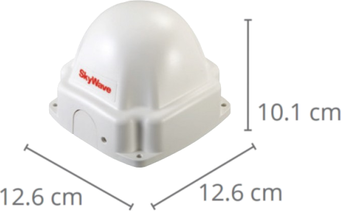
The on-board terminal is quick and easy to install, requiring just a 9-32V power supply and a clear view of the sky. It contains a GPS chip and an Inmarsat IsatDataPro satellite transceiver. As a voyage progresses, the vessel's position is transmitted in near-real time to CherSoft, where we determine the cells that were used on the voyage.
The tracking system exceeds the RENCs’ requirement of 99.8% accuracy in PAYS systems. Our system underwent extensive sea trials before gaining validation.
Works with all S-63 charting systems
The CherSoft PAYS system works independently of the ECDIS and works with all S-63 charting systems, making it compatible with any ECDIS or ECS. This is possible due to our scrupulous adherence to standards and our advanced satellite vessel tracking system.
Our expertise
We are experts in designing software for the marine industry. Read about how our expertise relates to PAYS:
Contact us
Contact us to discuss how PAYS can meet your marine chart purchasing needs.