Marine data distribution
CherSoft are experts at overcoming the problems associated with using the internet on board a ship. This includes difficulties in compressing marine data, particularly charts, and transmitting them over limited and/or expensive bandwidth.
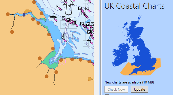
Our Universal Chart Server patented technology is at the backbone of many of our products as it reduces the data transmission bandwidth needed by about 50%*. It provides mariners with official up-to-date ENCs from NOAA®, PRIMAR® and AVCS alongside other critical navigational information such as weather and sea ice limits.
For the Hydrographic Office
We have many years of experience in data delivery, both electronically and on paper. Our systems can take a dataset and produce a print-ready copy of books and CDs for physical distribution, and data for electronic distribution.
We are heavily involved at the data production workflow end of hydrographic office systems, as well as driving improvements in the way data is consumed and used on board vessels.
For the chart agent
We can make life much easier for chart agents as we have a variety of solutions to work around their requirements. Our data distribution technologies can be integrated with existing CRM and payment systems. We can supply data delivery components to run within existing systems on hardware. We can also provide a fully hosted and managed service to deliver your data to your customers from our systems.
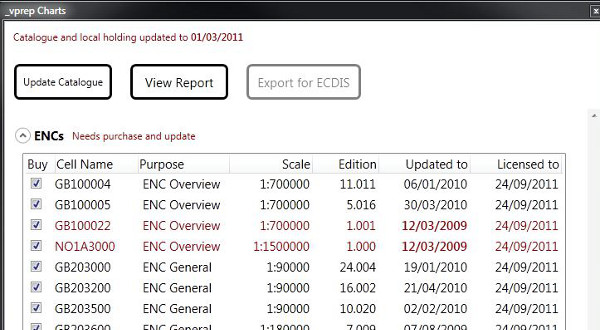
We use our expertise in data compression to minimise the bandwidth used in data delivery, saving on the time it takes to update the charts and as a result, lowering transmission costs. We feel that a simple question “Does this vessel have up to date chart data and permits for its current operational area?” should be easy for a mariner or chart agent to answer without worrying about cells, products, units, permits, editions and update numbers.
For everyone
Our Universal Chart Server allows users of our applications to quickly and easily access the full complement of official ENC charts, whether they are on ship or shore. Our patented ENC compression technology reduces bandwidth usage by about 50%* for users on satellite broadband connections. This promotes safe navigation by encouraging the regular updating of charts while underway.
*Transmission time can vary from 20% to 80%, depending on the amount and type of data.